Wobbly Otter Outdoors Videos
Custer State Park - Black Hills of South Dakota
- Details
- Written by Cris
- Hits: 2785
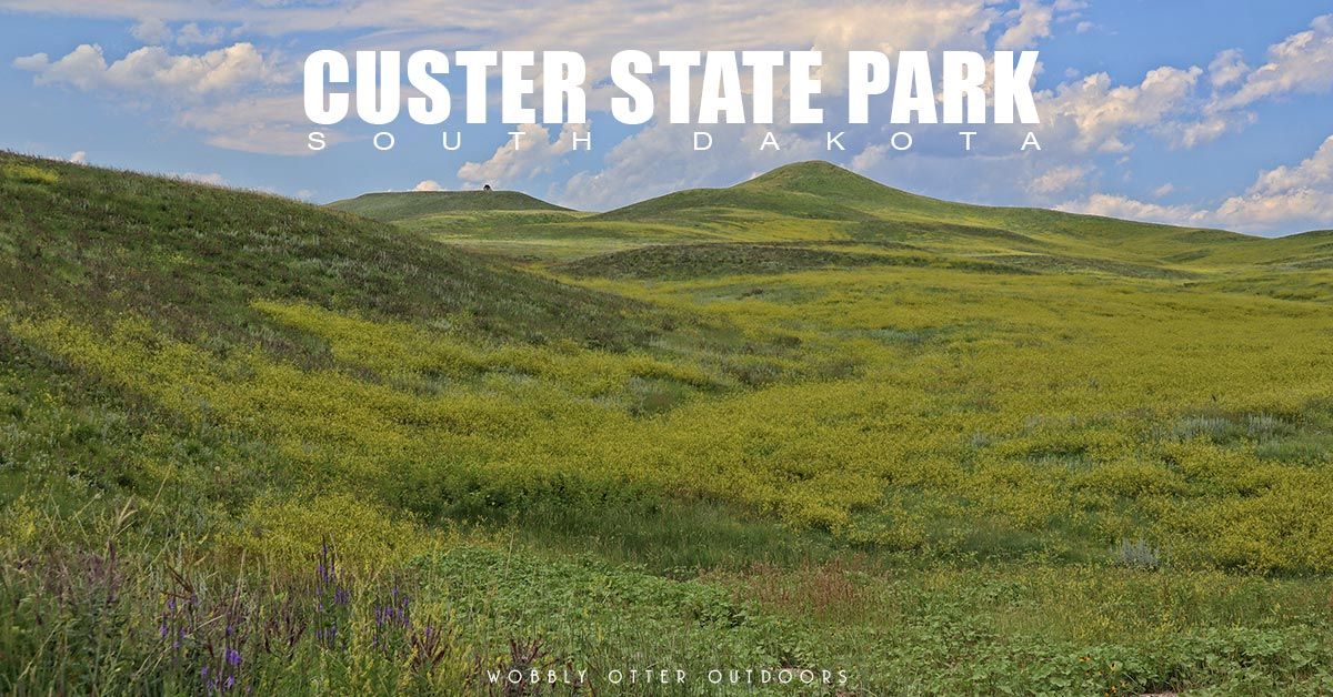
Custer State Park is 71,000 acres in size, and is located in the Black Hills of southwestern South Dakota.
In the video below, we show you all the sights and sounds of this most amazing place.
Thank you for watching. We hope you'll subscribe to get the best Wobbly Otter adventures, how to's, and gear reviews delivered directly to you.
The Mount Coolidge Lookout and Fire Tower was constructed by the Civilian Conservation Corps in the late 1930s. The stone tower is on top of a 6,023-foot peak, and offers some incredible views.
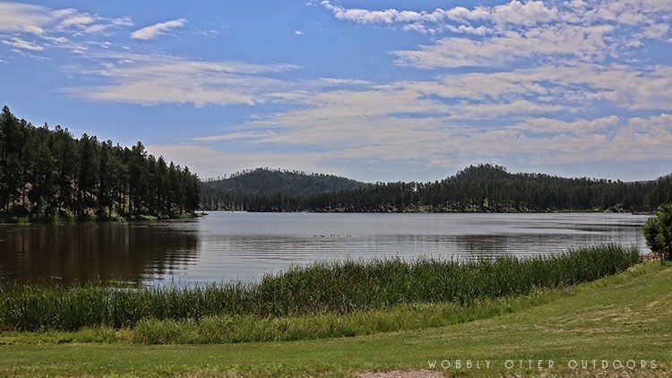
above: Stockade Lake
The first 36 bison are brought to Custer Wildlife Preserve in 1914. In 1919 Custer State Forest becomes Custer State Park.
Present day, there are about 1,300 bison in the herd.
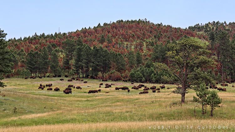
above: Bison Herd
The annual bison roundup is held the last Friday in September and is open to the public. The big bull bison are not included in the roundup because they are more aggressive and hard to round up. The purpose of the roundup is a part of Custer State Park's management plan to maintain a healthy balance between the number of bison and the condition of the grassland and how much food is available. New herd members are vaccinated, new calves are branded, cows are checked for pregnancy. Approximately 200 bison are separated out each year and are sold at auction.
We follow the Wildlife Loop Road for a little while, then are happy to find a dirt road to explore.
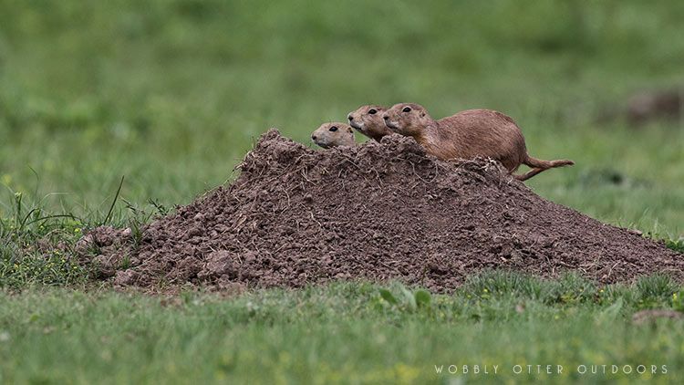
above: Pairie Dogs
They are just so cute.
There are several dirt roads that are open for public travel. Some are closed during our visit. We traveled on three dirt roads: CSP #3 (also called Oak Draw Road), Fisherman Flats Rd and Lower French Creek Rd.
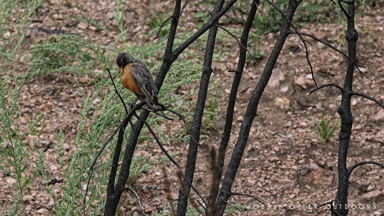
above: Robin resting in a bush burned by a past fire.
The little bird is fine. It just happened to have its eyes closed and head down when the picture was taken. Makes for a poignant image with the burned limbs and all.
Needles Highway scenic drive is 14 miles long its expected travel time is about 60 minutes.
Sylvan Lake was created in 1881. It's at an elevation of 6,145 feet (1,873 m) with a surface area of 17.3 acres. Sylvan Lake has 1 mile (1.6 km) of shore line and an average depth of 12.8 feet (3.9 meters). Maximum depth is 30 feet (9.1 meters).
Needles Highway is named for the needle-like granite formations you see along the way.
The Needles Eye Tunnel is 8'4" wide by 11'3" high. (2.5m wide x 3.4m high)
Iron Creek Tunnel is 9' wide by 11'4" high. (2.7m wide x 3.4m high)
More Information
Custer State Park, SD Game, Fish & Parks website: https://gfp.sd.gov/parks/detail/custer-state-park/
Custer State Park on Wikipedia: https://en.wikipedia.org/wiki/Custer_State_Park
Custer State Park Buffalo Roundup: https://www.travelsouthdakota.com/things-do/events/custer-state-park-buffalo-roundup
Custer State Park on TravelSouthDakota.com: https://www.travelsouthdakota.com/explore-with-us/great-8/custer
Mount Coolidge Lookout & Fire Tower: https://custerresorts.com/activities/nearby-attractions-and-activities/mount-coolidge-lookout-tower/
If you'd like to support Wobbly Otter Outdoors all you have to do is watch our videos. Okay, here are some other ways to support us too.
Note: Some of the product links on this page are affiliate links, and at no additional cost to you, we may earn a small commission if you make a purchase after clicking through the link. As an Amazon Associate we earn from qualifying purchases. By using these links you help support Wobbly Otter Outdoors. Thank you.